
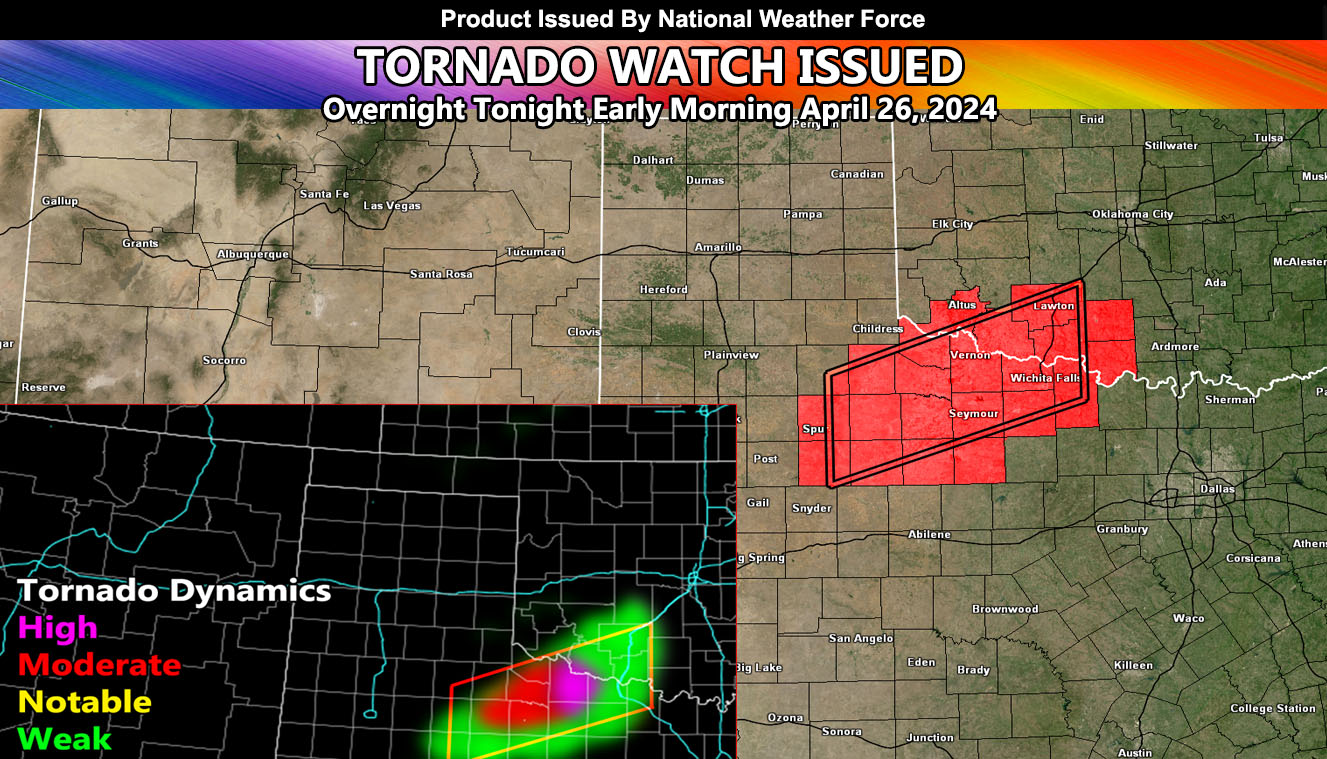
National Weather Force has issued a Tornado Watch effective tonight at 10pm and lasting till sunrise Friday for Northwest Texas and Southern Oklahoma, mainly along the Red River Valley.
Discussion: An upper-level low system will move into the area tonight. A dryline extending across Northwest Texas will be the focus spot for rapid severe thunderstorm development. This system will have enough instability and lift within the upper divergent zone to produce thunderstorms, capable of hail, wind, heavy rain, and of course lightning within and around the watch area.
National Weather Force Tornado Risk Model does paint a higher severe value in and around the watch zone, so a chance of tornadoes does exist as well, some could very well be strong.
The location for the strongest dynamics will be near the Vernon, Electra and Wichita Falls zones. Residents are urged to maintain tuned to their weather radio as this is a nighttime tornado risk.
– Raiden Storm –
https://www.nationalweatherforce.com
Master General Meteorologist – is the owner and CEO of National Weather Force and is the only one authorized to issue weather watches such as thunderstorm, tornado, hurricane, and severe. A consulting meteorologist with over 26 years’ experience for over 50 companies, including energy, agriculture, aviation, marine, leisure, and many more areas. He has certs from Mississippi State for broadcast met and Penn State forecasting certs MET 101, 241, 341 and 361 as a meteorologist, but before then was completely self-taught, barely learning a thing from the schools that he did not already know.