
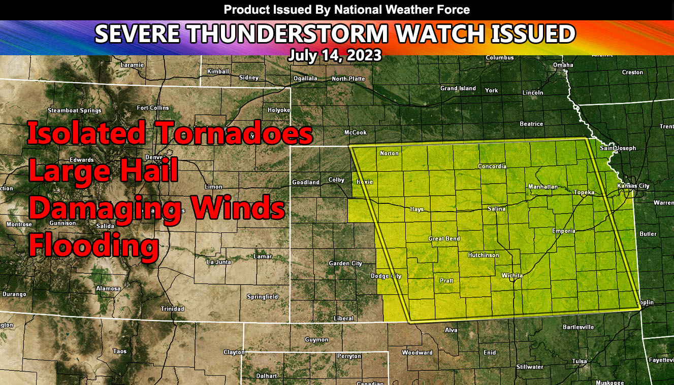
National Weather Force has issued a Severe Thunderstorm Watch effective for parts of Kansas, effective this afternoon, evening, and until midnight tonight.
An upper-level system out of the west will move into the region today. Upper lift will be present, which is normal for this time of year in these areas. Dewpoints are up and the temperature is rising. Backing southeast winds will accompany the surface low to bring a tornado probability, mainly along the watch area. Storms will move predominately to the southeast with time.
The strongest hail/wind dynamics will be across North-Central Kansas, between Concordia and Salina.
National Weather Force Tornado Risk Analysis Model (TRAM) is pegging a weak tornado dynamic risk today in the focus areas spoken of, which means that isolated tornadoes cannot be ruled out within the lone supercell clusters and/or solid line of QLCSs.
Large hail and damaging winds will also accompany the watch area.
- Raiden Storm –