
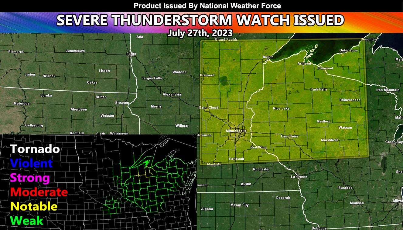
National Weather Force has issued a Severe Thunderstorm Watch effective for parts of the eastern half of Minnesota, the northern half of Wisconsin, and the western section of the Michigan Upper Peninsula.
An upper-level system out of the west will move into the region today with the main jet dynamics. Dewpoints are up and the temperature is rising. Backing southeast winds will accompany the surface low to bring a tornado probability window as well, mainly along the watch area. The hardest hit will be a corridor from Eastern, Minnesota into Western Wisconsin, with the highest tornado probability on the NWF Model being Northwest Wisconsin. Storms will move predominately to the east with time along a line with some discrete cells with it.
National Weather Force Tornado Risk Analysis Model (TRAM) is pegging a weak to notable tornado dynamic risk today in the focus areas spoken of, which means that tornadoes cannot be ruled out within the line of storms that will race on through.
Large hail and damaging winds will also accompany the watch area.