
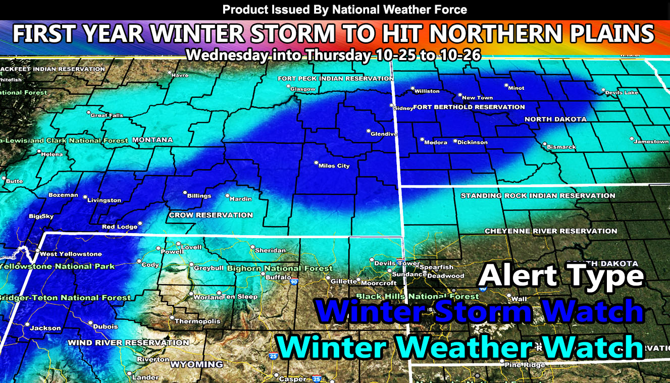
National Weather Force has issued a Winter Storm Watch for parts of the Northern Plains from Yellowstone, Montana, and North Dakota, effective Wednesday into Thursday.
A system diving into the Pacific Northwest that will bring snowfall to their higher elevation mountain zones will transverse Idaho on Tuesday. The system is expected to bring very cold air with it, which will start developing snowfall across Northwest Wyoming and Central to Eastern Montana early Wednesday, finally moving into North Dakota Wednesday overnight and into Thursday.
National Weather Force snow models (not pictured yet) shows that the Winter Storm Watch area (dark blue on map above) will have 6-12″ of snowfall, especially that margin of snow in the Billings, Montana forecast zones.
This system will not having a strong surface low; thus, blizzard conditions will not be likely in the watch area, with the exception of the higher areas of Yellowstone where the jet stream will interact more, giving blizzard conditions there on Wednesday.
Snowfall maps will be given on the final forecast on your Tuesday, but for snow the NWF outline is risk/alert assessment.
Raiden Storm
Master General Meteorologist