
 Outlook:
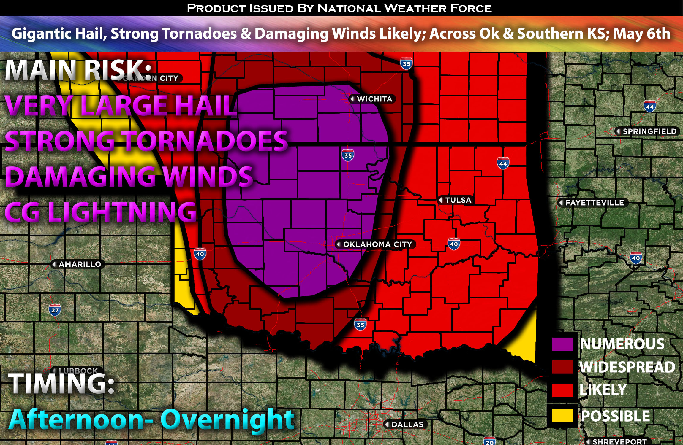
Significant-severe weather is expected, including the potential for giant hail from 3″ to 4″ in diameter, gusts around 80 mph, and strong/potentially long-track tornadoes across Oklahoma. Check below for the details on timing, impact and much more.
Overall Forecast:
An open upper-level system is forecasted to progress eastward through the central Rockies and into the central Plains on Monday, gradually becoming increasingly negatively tilted over time. Strong to very strong mid-level flow will accompany this system, spreading eastward and northeastward into the southern High Plains by Monday afternoon and evening. Given the complexity of this setup, let’s delve further into the details to break it down.
Across Oklahoma and Southern KS:
Simultaneously, there will be significant low-level moisture advection, leading to mid-60s dewpoints reaching the Oklahoma/Kansas border by early afternoon. This rising low-level moisture, combined with steep mid-level lapse rates within a highly unstable airmass ahead of the approaching shortwave across much of Oklahoma, will likely result in the development of numerous severe storms as this wave interacts with the airmass later in the afternoon and evening.
Some capping is expected to persist until around the afternoon, which can benefit storm development by allowing the ingredients to intensify. With ongoing low-level moisture advection and daytime heating, extreme destabilization of the air mass is anticipated within a few hours. Combined with very strong instability and shear, including low-level shear especially in the evening hours, these dynamics would favor discrete storm formation in Oklahoma. As storms begin to develop, they are likely to rapidly intensify, becoming supercellular and capable of producing all severe hazards. This includes giant hail measuring 3+ inches in diameter, severe gusts up to 80+ mph, and the potential for strong tornadoes, including a few long-track violent tornadoes.
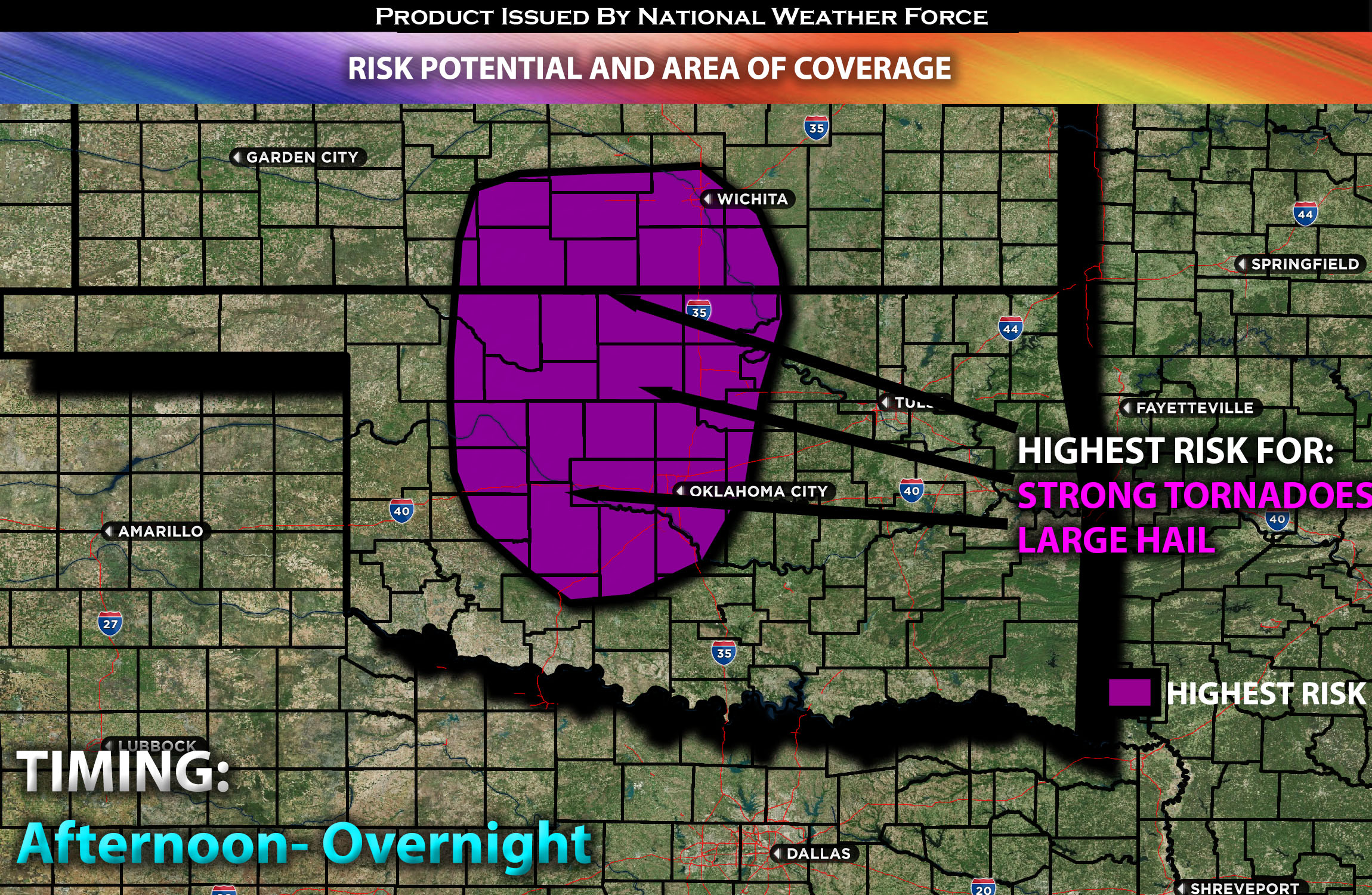
Concentrated Risk:
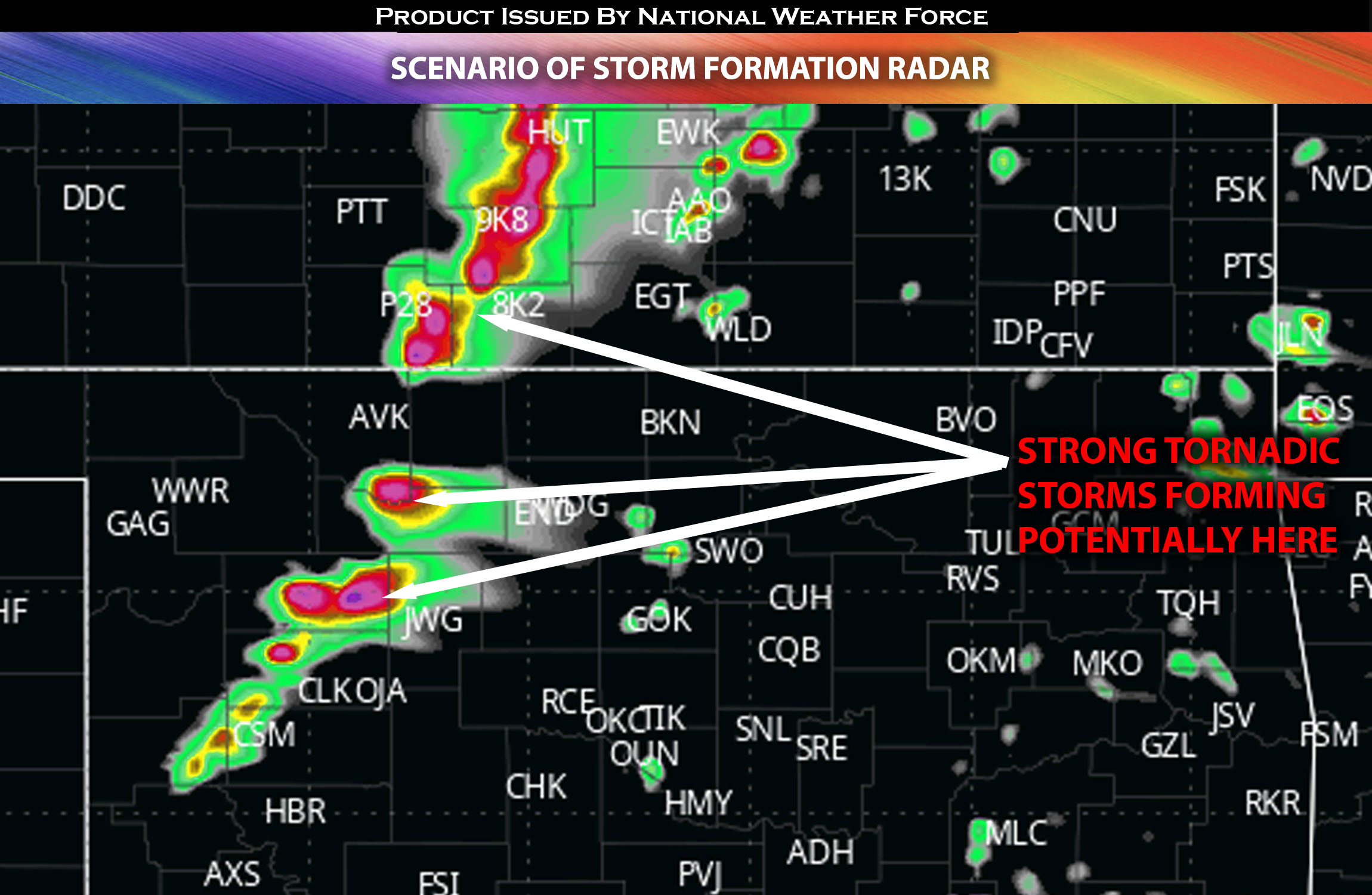
 Future Radar Scenario:
 Overnight:
Main Risk: gigantic hail, strong tornadoes a few long track/violent (if ingredients align), destructive winds and CG lightning (cloud to ground).
Stay tuned for more updates.
Sina⚡⚡
With over a decade of experience in forecasting severe thunderstorms, this individual is a seasoned forecaster and developer. Their expertise in severe weather forecasting and computer science is entirely self-taught, complemented by a foundation in Atmospheric Science from UNCO and an IT background from WGU. They have dedicated their efforts to developing innovative tools that enhance the accuracy of analyzing large hail and tornadoes. As a significant contributor and partner at National Weather Force Innovations LLC, they have played a crucial role in providing accurate and timely information. Additionally, they have been instrumental in developing tools and organizing projects that focus on accuracy and performance, ensuring those affected are well-informed.