
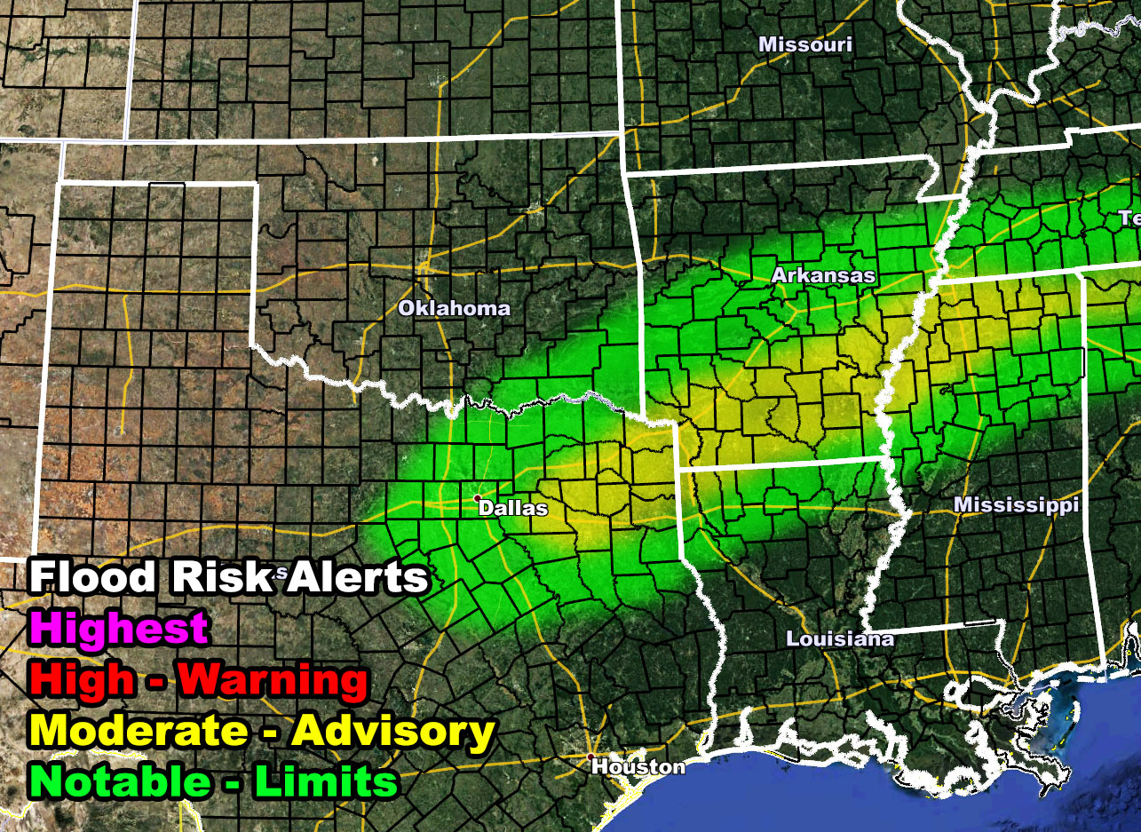
A round of heavy rain and thunderstorms is expected to develop along a warm-front boundary stretching from Northeast Texas, east-northeast through Northern Louisiana and Mississippi, north to Southern Arkansas on Thursday night and going into Friday. The National Weather Force flood risk model (watch zone) shows a yellow value. While not terribly strong, it does work with the melting snow/ice in some of the area to create an elevated flood hazard.
Want notifications? Sign into the free email alert system and choose your state area(s) -Southern California and Arizona are not served though.
LINK TO REGISTER IF ELSEWHERE – http://www.nationalweatherforce.com/national-weather-force-email-alert-system-sign-up/
Have a comment? Ask on the FB post – You can even ask your city and get an answer if you are confused – –
NWF Flood Watch Issued for Parts of TX, LA, AR, MS Thursday night through Friday morning
Read more -…
Posted by National Weather Force on Wednesday, February 24, 2021