
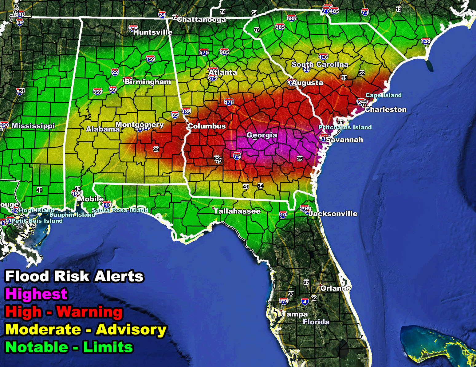
 A round of heavy rain and thunderstorms is expected to develop along a warm-front boundary stretching from Southern Mississippi, east-northeast through to South Carolina Tuesday evening through Wednesday morning, Tuesday overnight being the strongest of the event. Some of the thunderstorms may be marginally severe weather hail, strong winds, and even isolated tornadoes. The National Weather Force flood risk model (warning zone) shows a red value in widespread form so this is a sizable alert zone. Use the map embedded in this write-up for your county location and type of alert issued based on the NWF in-office model.
Want notifications? Sign into the free email alert system and choose your state area(s) -Southern California and Arizona are not served though.
LINK TO REGISTER IF ELSEWHERE – http://www.nationalweatherforce.com/national-weather-force-email-alert-system-sign-up/
Have a comment? Ask on the FB post – You can even ask your city and get an answer if you are confused – –
NWF Flood Watch and Warning Issued for the Southeastern United States Tuesday evening, overnight, and into Wednesday…
Posted by National Weather Force on Monday, March 1, 2021