
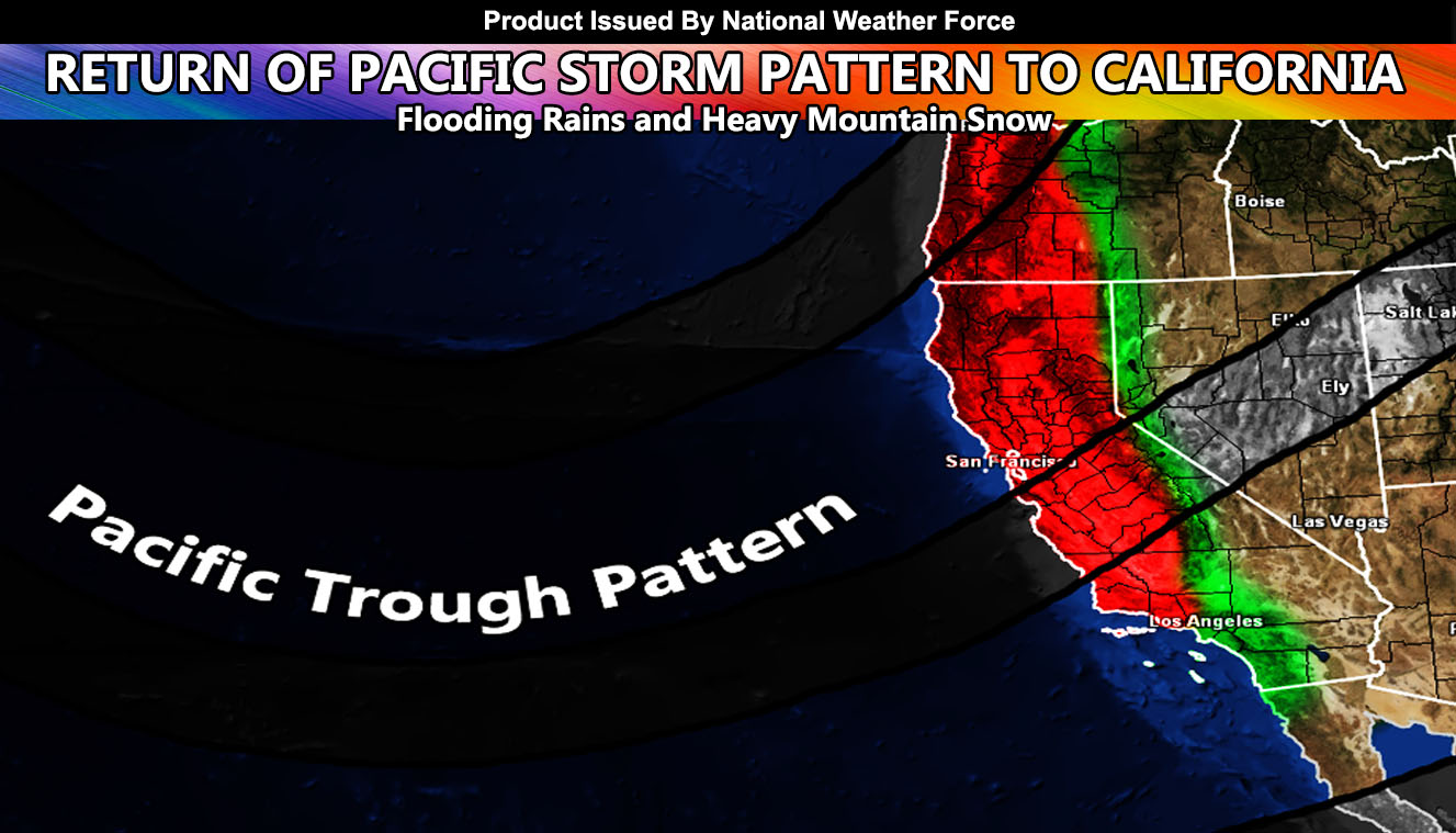
National Weather Force has issued a Long-Range Weather Advisory for flooding low land rains and heavy mountain snow for Central and Northern California after November 27th so read on for details …
A lull in activity has been present across all of California with a ridge of high pressure dominating to the west, and a low pressure in Eastern Canada driving storms east of the area, bringing drier conditions and offshore winds.
For Thanksgiving, expect the ridge to the west to finally push eastward, directly over California. This will bring a warm-up to the region for a brief few days. This warm-up will be replaced by a trough of low pressure well west of the state. This will bring several impulses in after November 27th. If you are planning on traveling, and/or will be going up to the Sierra Nevada resorts, get there before this hits. This will be expected to hit around Sunday/Monday, the weekend after Thanksgiving.
National Weather Force will be issuing Winter Storm Watches well ahead of the system for all resort locations along the Sierra Nevada Range, but you have your long-range advisory on what to expect for your travel plans now.
If you are in Southern California, your storm pattern article is at Southern California Weather Force and can be viewed by Clicking Here
SIGN-UP TO THE FREE NWF E-MAIL ALERT SYSTEM FOR YOUR AREA HERE WHERE YOU PICK YOUR AREA IN YOUR OWN CONTROL PANEL BY STATE LOCATION AND GET NOTIFIED WHEN A POST IS MADE FOR YOU https://www.nationalweatherforce.com/national-weather-force-email-alert-system-sign-up/
FOLLOW the Facebook Page after reading this and interact with the post made about this, whether sharing, liking, or commenting … It will be answered
CLICK HERE TO FOLLOW THE MAIN FACEBOOK PAGE