
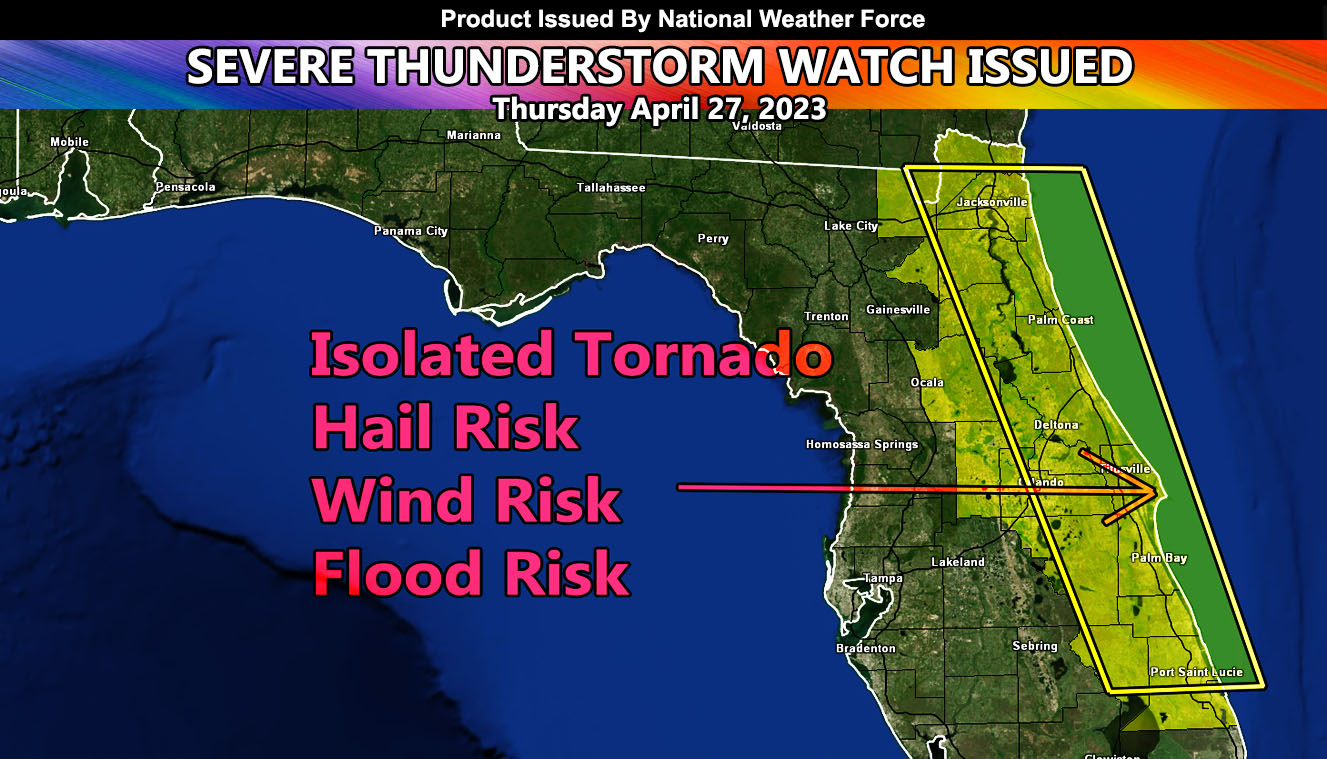
National Weather Force has issued a Severe Thunderstorm Watch for a region stretching from Eastern and Northeastern Florida zones, covering a large part of the Florida population, that of which the main target is the watch area, with a smaller target for the strongest dynamics being Cape Canaveral, effective this evening until midnight tonight …
A system coming out of the Gulf of Mexico today will move eastward with time. Already there is a confirmed tornado with it in the NWF Tornado Watch zone issued for the Florida Panhandle. Upper ascent ahead of the squall-line will bring about the seabreeze convergence zone in Central Florida, pushing eastward to the coast with time. An explosion of storms will line the entire watch box area, including the areas around the Orlando Theme Park zones. So, if you are planning to be there, expect increasing severe thunderstorms.
Storm cells will produce hail and wind risks, as well as the chance of an isolated tornado and torrential downpours that will lead to flooding in spots. It is not recommended to be at the beach this day either or have small crafts offshore. Like I said, the best chance for a tornado will be around the Cape Canaveral area, but the entire box does have isolated tornado potential with it. This is just short of the official National Weather Force tornado watch issuance, but will remain as a severe watch with tornado wording …