
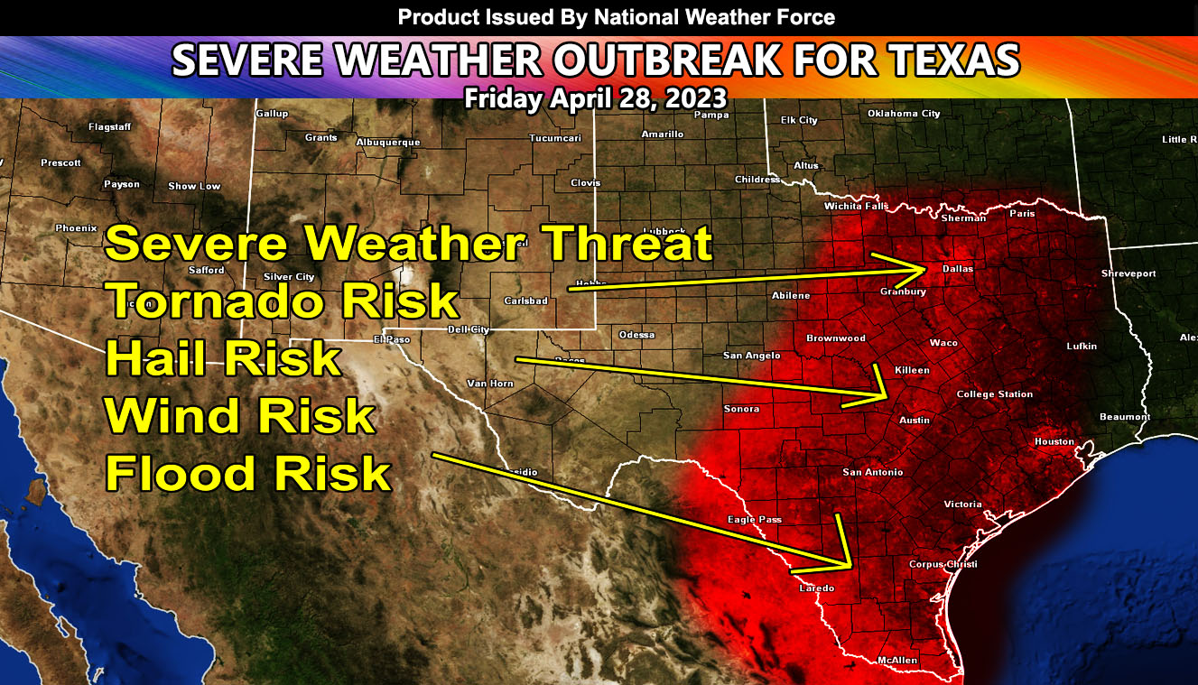
National Weather Force is monitoring a severe weather outbreak that is scheduled for the eastern half of Texas for your Friday. This system will be coming out of the Rockies today, finally approaching Texas by morning on Friday. A surface low in West-Central Texas will be the focus of the southeasterly backing winds into the developing dryline. The dryline will extend from North Texas north of Dallas-Fort Worth, and head south through the Metroplex, through Hillsboro/Waco, and continuing south through Austin, San Antonio, and finally to the Eagle Pass areas and into Mexico. This will be the main focus.
National Weather Force models indicate a calculation of the cap breaking to be about 3pm local time. This means that until then, the supercells will not be in the area. Given the rapid cooling of the mid-levels from 7c to 1c in just a few hours, the cold air advecting at this level will be enough to break the cap and start this severe weather outbreak.
Storms from the dryline will continue pushing eastward across the red-shaded zone within this article. The risk of tornadoes, large hail, damaging winds, and flooding will all be within this system. If you are in the shaded area, continue to monitor the latest forecasts here at National Weather Force for further weather watches that would be issued the morning of the event, issued across the free e-mail alert system that you can join below.