
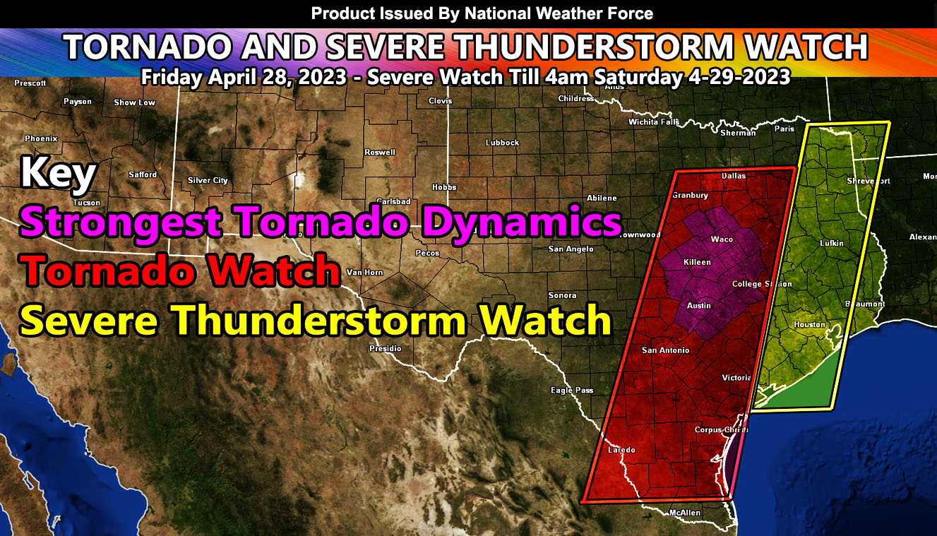
National Weather Force has issued a Tornado Watch effective this afternoon at 2pm until midnight tonight. The tornado watch extends along a line from Southern Texas northward to the Dallas-Fort Worth Metroplex zones at the northern extent. As you see in the image provided in this article, there is a magenta color. This color indicates the National Weather Force’s tornado model in high resolution sparking a smaller area within the main tornado watch to have the strongest tornado dynamics. Storms within this area have the power to produce strong and, in some cases, violent tornadoes. The areas within this will be Waco, Killeen, and Austin.
The cap will break sometime around 2pm local time along the western edge of the tornado watch zone. This will be your dry-line, which will then surge eastward with time. Dewpoint this morning in the higher risk zone is in the upper 60s and 70. Temperatures are in the 70s and climbing. Storms will jet off to the northeast through the Dallas areas as well. I do not think the Metroplex will see the strongest dynamics, but you are still within the northern end of the watch zone, so you still have the chance of a tornado, albeit not too strong.
Storms will move through the evening and into the National Weather Force Severe Thunderstorm Watch zone tonight, with the main threat being wind, as far as Houston, Texas and then finally exiting the watch zone by 4am local on Saturday morning, ending the watch period.
In addition to the tornado threat, large hail and damaging winds as well as localized flooding will hit the region.