
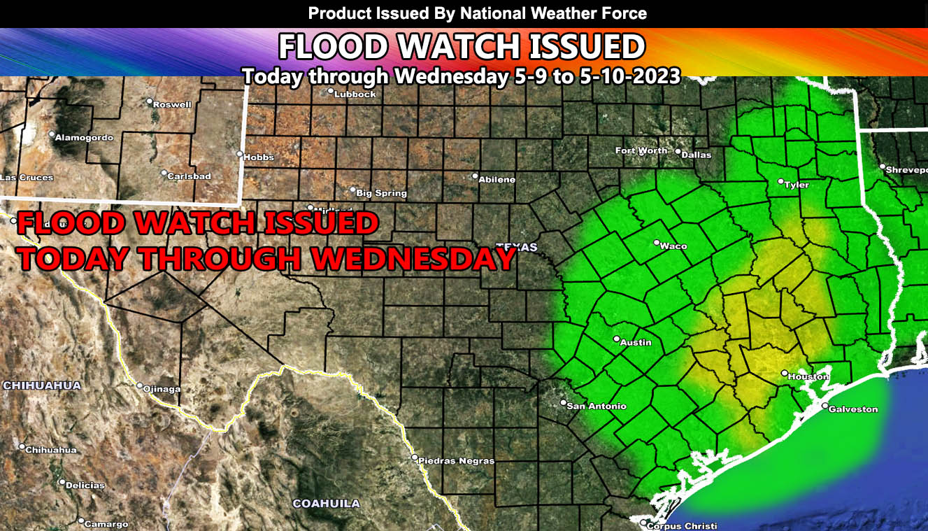
National Weather Force has issued a Flood Watch for the Eastern half of Texas, effective today through Wednesday as a storm system out of the west moves in.
A storm system out of the west is bringing in Gulf of Mexico moisture into the watch area this morning. As we move along the day, the Houston, Texas forecast zones will have increasing thunderstorms, some of them will have strong winds and large hail at times, giving it a marginal severe thunderstorm risk. Storms today will hang around that area for most of the day, but a break is expected overnight tonight, with a return of storms/flooding to the watch area for your Wednesday.
On Wednesday, the focus shifts to areas in Eastern Texas, north of Houston. Between today and Wednesday, today will be the stronger day of storms in Houston. So, flooding, strong winds, and hail will all be likely within the watch area. The yellow-shade within the image of this publication alert is where the heaviest prolonged rainfall will fall