
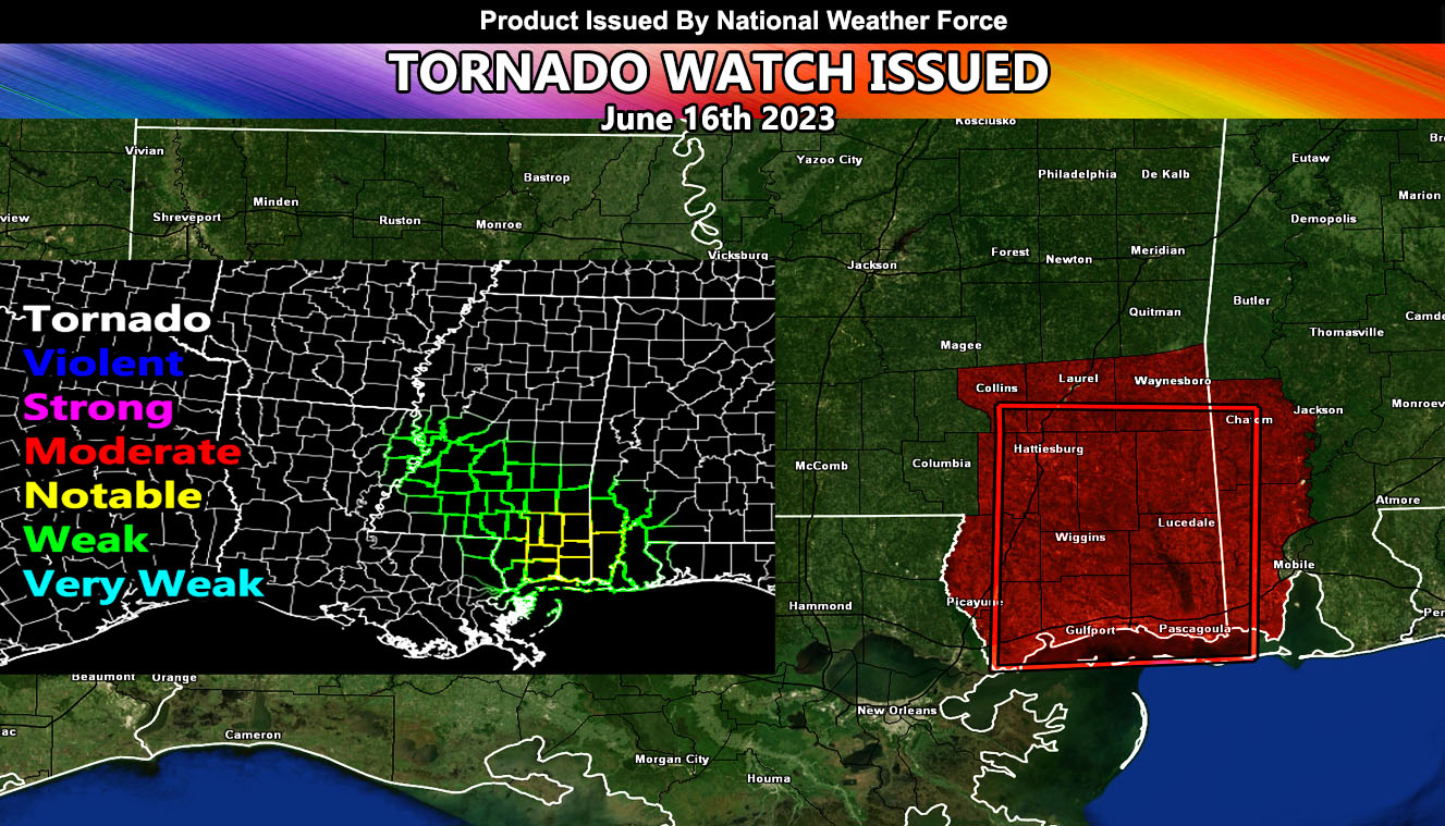
National Weather Force has issued a Tornado Watch effective for parts of Southeast Mississippi and Southwest Alabama now until 10pm tonight with notable tornado dynamics.
An upper-level system out of the west will move into the region today. Upper-level ascent ahead of the system will pop-off isolated supercells, which will be enough for a window of tornado potential in this very small watch area. Dewpoints are up and the temperature is rising. Backing southeast winds will accompany the surface low to bring a tornado probability, mainly along the watch area and centering the boxed area of Southeast Mississippi and those counties surrounding it. Storms will move predominately to the northeast with time.
National Weather Force Tornado Risk Analysis Model (TRAM) is pegging notable tornado dynamics risk today in the focus areas spoken of, which means that up to EF1-2 tornadoes cannot be ruled out within the lone supercell clusters.
Large hail and damaging winds will also accompany the watch area.