
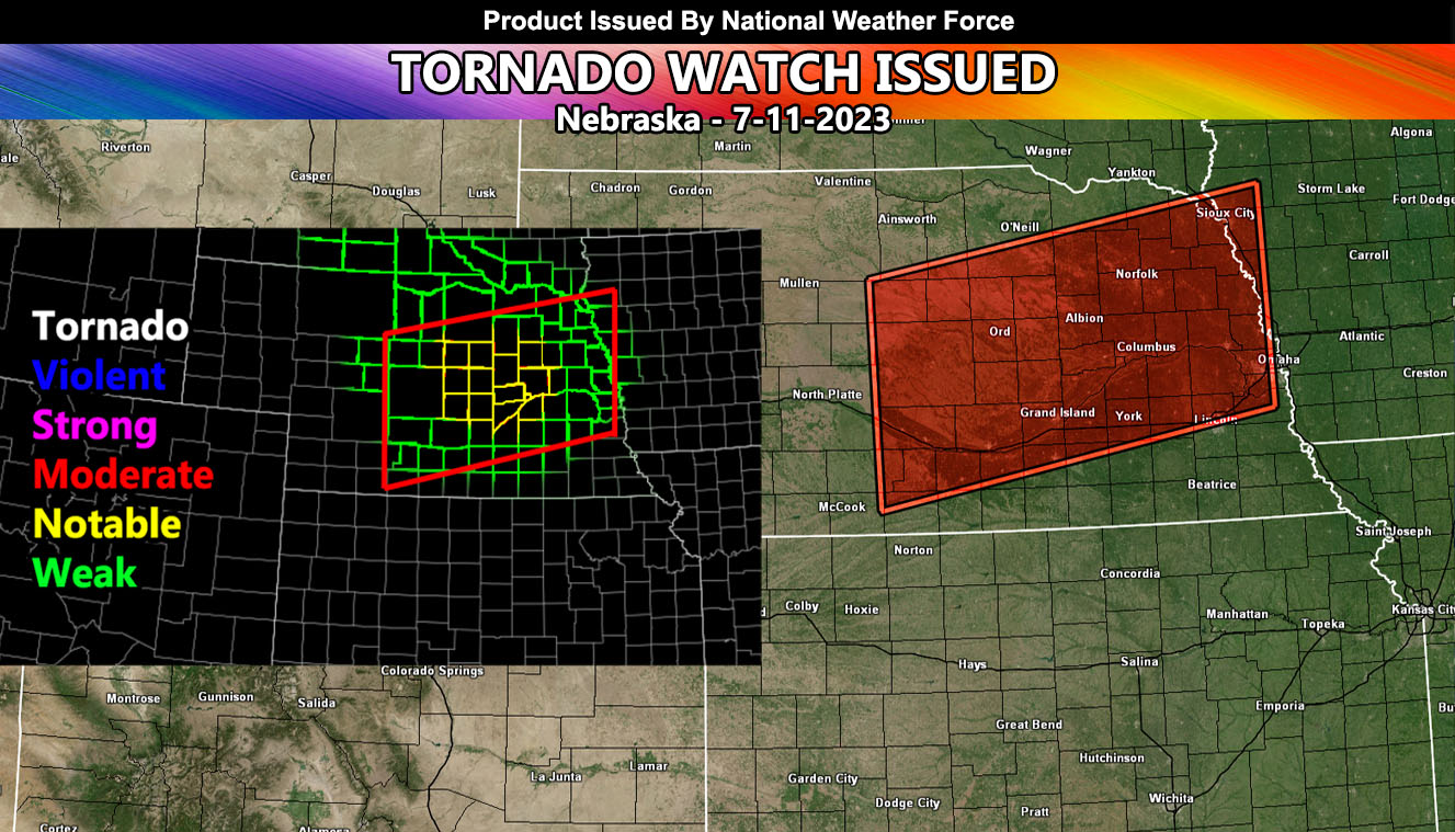
National Weather Force has issued a Tornado Watch for the eastern half of Nebraska, effective this evening until midnight.
An upper atmospheric trough currently over northwest Montana is projected to shift into the high plains by mid-afternoon, instigating convection over areas in South Dakota. Coupled with heightened instability, ample moisture, and vertical shear, this will amplify the risk for severe thunderstorms capable of generating large hail (sometimes very large), destructive winds, and tornadoes due to the elevated Low-Level Jet.
The weather activity will shift and intensify southeastward into north and central parts of Nebraska. Here, the chances for tornadoes will increase due to varied atmospheric shear levels. As these storms advance, they will mainly pose a damaging wind threat due to the downward instability and will continue their eastward movement through the region.
The National Weather Force Tornado Risk Model (small left image within the larger article image) shows a small area of notable tornado dynamics, centering Grand Island, Saint Paul, Columbus, and Fullerton, Nebraska.