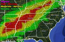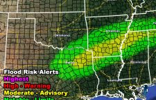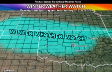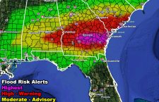
NWF Flood Watch and Warning Issued for the Southeastern United States Tuesday evening, overnight, and into Wednesday morning
A round of heavy rain and thunderstorms is expected to develop along a warm-front boundary stretching from Southern Mississippi, east-northeast through to South Carolina Tuesday evening through Wednesday morning, Tuesday overnight being the strongest of the event. Some of the thunderstorms may be marginally severe weather hail, strong winds, and even isolated tornadoes. The National Weather Force flood risk model […]
Read more ›