
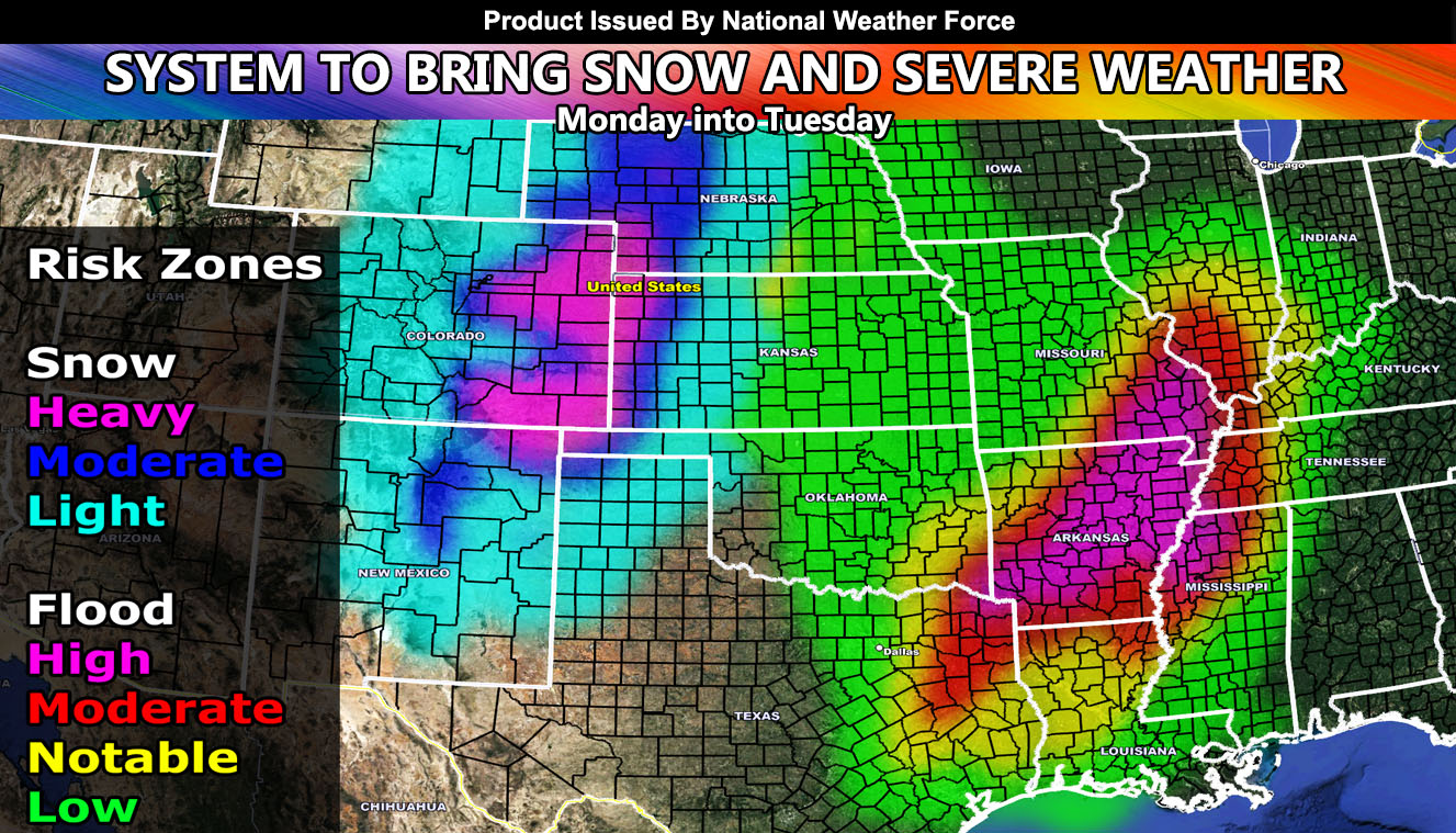
National Weather Force has issued a Special Weather Statement for two separate areas as a major storm system crosses the heart of the nation Monday into Tuesday for snow in the Rockies and Western Plains and Severe Weather in the south so read on for details and see the larger maps …
FOLLOW the Facebook Page after reading this and interact with the post made about this, whether sharing, liking, or commenting … It will be answered
CLICK HERE TO FOLLOW THE MAIN FACEBOOK PAGE
A system is crossing California today, which is bringing rain and mountain snow. This same system diving in will be lifted northeast on Monday across Texas and Oklahoma. A surface low developing over the Texas Panhandle will be the focus spot for all the activity that will be seen.
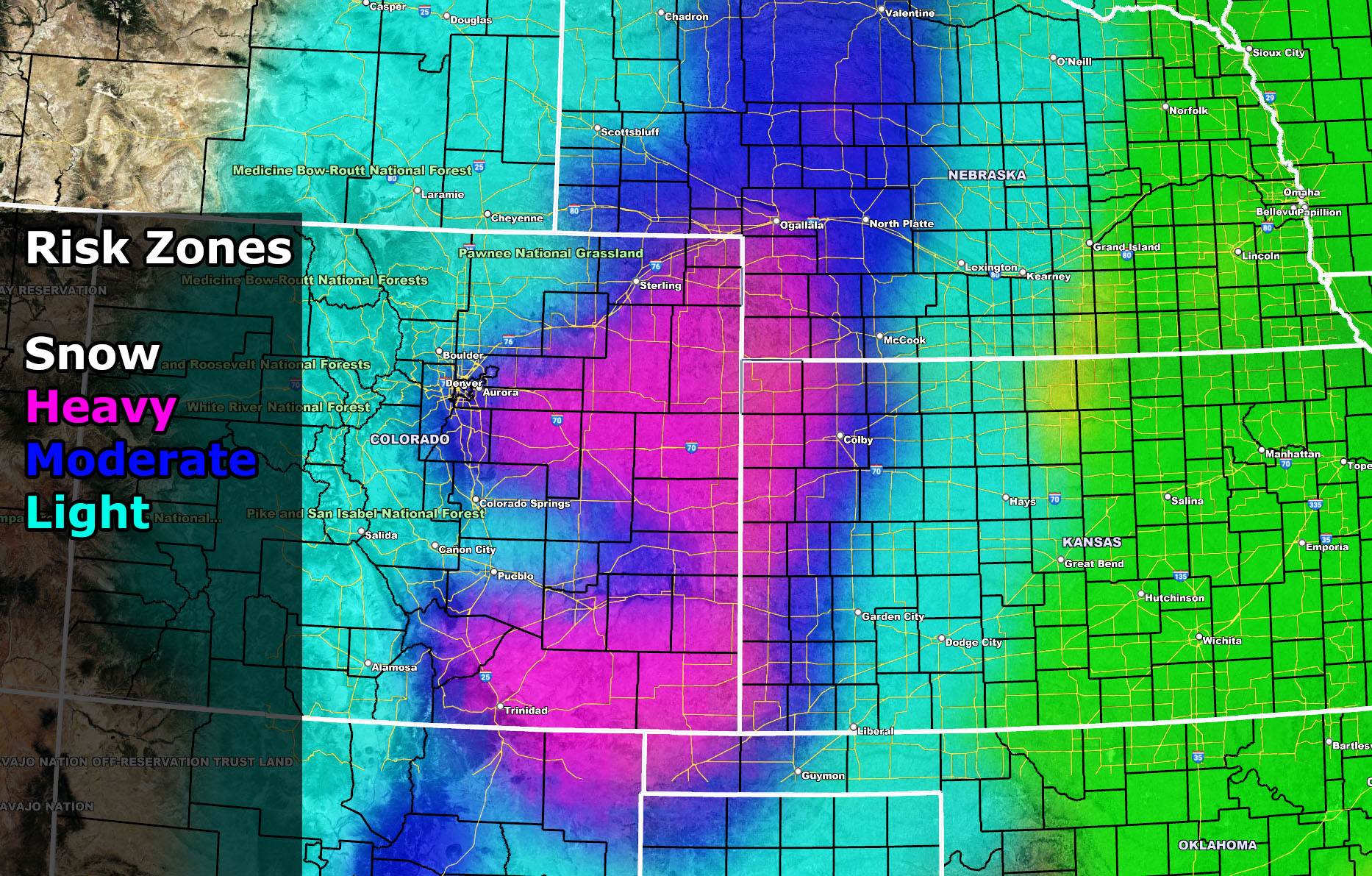
First, the snowfall will develop across Colorado on Monday, getting heavier as the day goes on. The best area of the heaviest snow where Winter Storm Warnings (sometimes blizzard) will be needed will be from most of the Western half of Nebraska, southward to the Eastern half of Colorado, including Denver, extreme Western Kansas, extreme Northeast New Mexico, and the Western Oklahoma Panhandle. This is the zone for Monday’s heavy snowfall event based on the current pattern I see along with the medium range National Weather Force models developed in-office.
The second of the events will be the southeast flow from the Gulf of Mexico, upping the moisture content across the Southern Plains, which includes parts of Oklahoma, Texas, Louisiana, Mississippi, Tennessee, Kentucky Illinois, and Missouri … Details on this are sketch right now, but on Monday morning we could easily already see elevated thunderstorms for hail east and over Dallas. This is just a bit interesting because this could limit tornado potential for this event should these stick around. The main focus for any tornadoes should be east of Dallas in the Eastern Texas zones surrounding the Lufkin forecast area and surrounding. In fact, this looks highly similar to this past week where we had heavy snow in Colorado and severe storms in the Southern U.S. Tornado potential will mainly focus on whether the elevated storms limit most of the instability as it did this past week.
The severe storm activity will move east with time Monday evening into Tuesday across Louisiana into Mississippi yet again. These do continue to contain the risk of hail/wind/tornadoes –
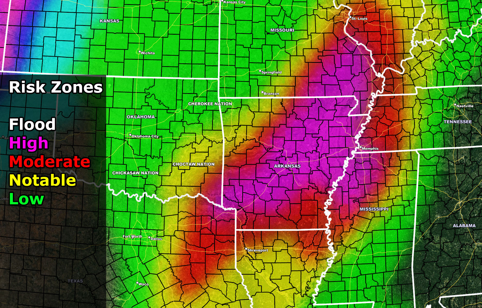
Further north, the least instability zone will be where the flooding will be. As the map in this article shows with the NWF model, Monday evening into Tuesday, the highest risk of flooding where flood watches need to be issued (in fact that is a flood watch officially now from this office) will be across the eastern half of Texas, Southeast Oklahoma, Northern half of Louisiana westward to the rest of the states listed above. Use the flood risk model for your risk …
Keep in mind this shows major metro areas in the NWF Flood Watch so areas like Shreveport, LA – Little Rock, AR – Memphis, TN …
The following two images below will be the zoom-in images of the main article images showing where the worst of the snow and flooding will be …
These images ARE CLICKABLE
SNOW CRITERIA:
Anything Moderate and Higher is Winter Storm Warning criteria
Anything Light is Winter Weather Advisory
FLOOD CRITERIA:
Anything NOTABLE/MODERATE or higher is Flood Watch criteria
HOW TO GET THESE ALERTS?.
SIGN-UP TO THE FREE NWF E-MAIL ALERT SYSTEM FOR YOUR AREA HERE WHERE YOU PICK YOUR AREA IN YOUR OWN CONTROL PANEL BY STATE LOCATION AND GET NOTIFIED WHEN A POST IS MADE FOR YOU https://www.nationalweatherforce.com/national-weather-force-email-alert-system-sign-up/
FOLLOW the Facebook Page after reading this and interact with the post made about this, whether sharing, liking, or commenting … It will be answered
CLICK HERE TO FOLLOW THE MAIN FACEBOOK PAGE