
Issued or Partial Issued States: Southern San Joaquin Valley – Map inside shows affected state areas.
Site: National Weather Force has issued a Thunderstorm Watch effective 3pm today until midnight tonight …
Date: 3/19/22 at 10:45am Pacific Time
Forecast: A trough axis west of Santa Cruz and Watsonville will swing through the area this afternoon through half of tonight. This will steepen the instability rates and with the upper divergence moving in, sometime between 3pm and midnight today/tonight will be the window for thunderstorms to form across the Southern San Joaquin Valley.
This is the demonstration of the continuing development of the in-office thunderstorm model, which does predict thunderstorms during the Fall, Winter, and Spring Seasons, working on the cold-core of a system.
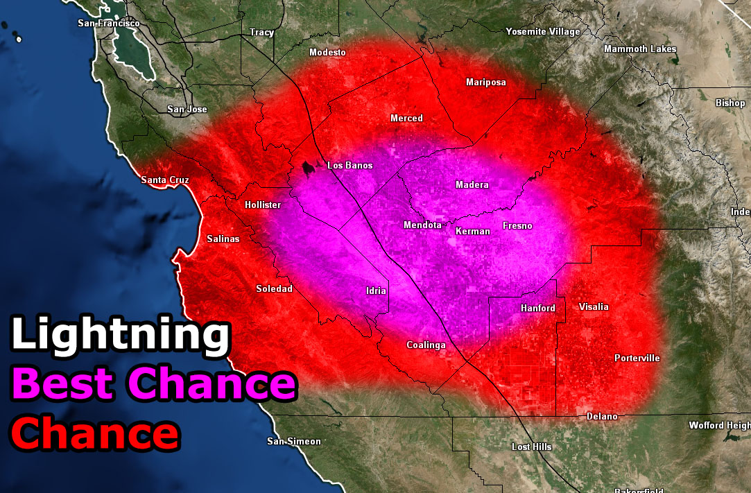
The center of the storm dynamics suggests it will be along the I-5 corridor near Mendota, Indria, Kerman, Madera, Fresno, and Hanford.
The southern edge of this nears the Southern California Weather Force forecast area around Delano … so you may see the storms if you’re living there or anywhere in Kern County from a distance … Delano being the closest to hear thunderstorm … but at the moment I’m keeping most of the activity north of there.
HOW TO GET THESE ALERTS?.
SIGN-UP TO THE FREE NWF E-MAIL ALERT SYSTEM FOR YOUR AREA HERE WHERE YOU PICK YOUR AREA IN YOUR OWN CONTROL PANEL BY STATE LOCATION AND GET NOTIFIED WHEN A POST IS MADE FOR YOU https://www.nationalweatherforce.com/national-weather-force-email-alert-system-sign-up/
FOLLOW the Facebook Page after reading this and interact with the post made about this, whether sharing, liking, or commenting … It will be answered
CLICK HERE TO FOLLOW THE MAIN FACEBOOK PAGE