
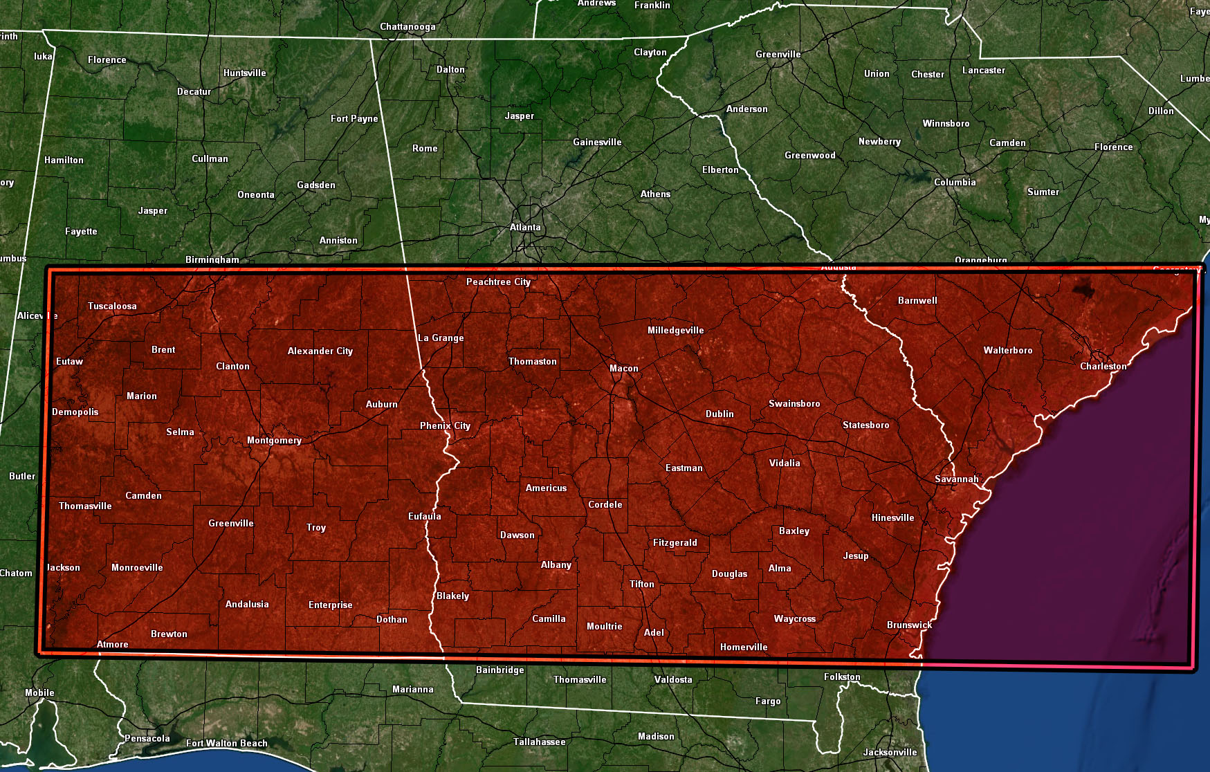
Issued or Partial Issued States: AL, GA, SC – Map inside shows affected state areas.
Site: National Weather Force has issued a Tornado Watch effective today, Wednesday 4-6-2022 – These locations are still picking up from yesterday’s storms and tornadoes are set to hit the same areas.
Date: 4/6/22 at 5:15am Eastern Time
Forecast: A surface low will pass to the north, dragging a meso-low from west to east across the watch area. This will be the focus spot for rapidly developing thunderstorms ahead of the main cold-front. This warm-front will be our focus for this watch today.
Temperatures climbing into the 70s with dewpoints in the 70s as well will yield to surface instability values of 2,000 – 3,000 j k/g. This, with helicity values in the lower levels of 150-250 will certainly bring tornadoes in the region.
These values also indicate that the tornadoes within the watch area, mainly across the southern half of Georgia (least in AL) into Southern South Carolina, will be strong, maybe even violent in some of those areas.
The Alabama watch area has tornado dynamics, but far weaker than the Georgia/South Carolina section of the watch.
These locations are still picking up from yesterday’s storms and tornadoes are set to hit the same areas.
A NWF Tornado Watch is issued when conditions are favorable for tornadoes in or around the watch area and the wording will describe what type, whether isolated, weak, strong, violent etc –
HOW TO GET THESE ALERTS?.
SIGN-UP TO THE FREE NWF E-MAIL ALERT SYSTEM FOR YOUR AREA HERE WHERE YOU PICK YOUR AREA IN YOUR OWN CONTROL PANEL BY STATE LOCATION AND GET NOTIFIED WHEN A POST IS MADE FOR YOU https://www.nationalweatherforce.com/national-weather-force-email-alert-system-sign-up/
FOLLOW the Facebook Page after reading this and interact with the post made about this, whether sharing, liking, or commenting … It will be answered
CLICK HERE TO FOLLOW THE MAIN FACEBOOK PAGE