
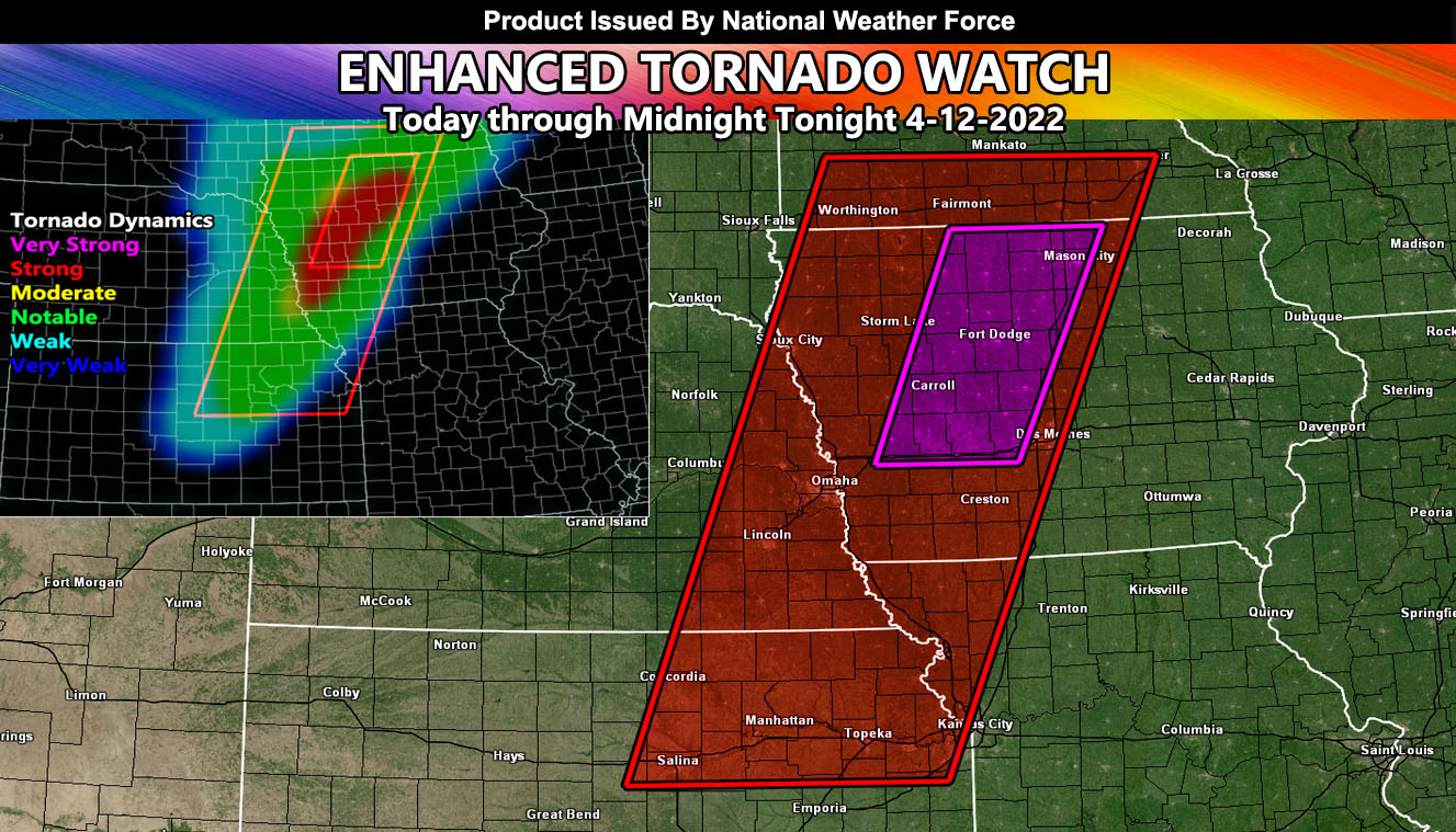
Issued or Partial Issued States: IA/NE/MN/KS/MO – Map inside shows affected state areas.
Site: National Weather Force has issued an Enhanced Tornado Watch effective now through midnight central … THIS IS A DANGEROUS SITUATION WITHIN THE ENHANCED TORNADO WATCH OUTLINE FOR IOWA …
Date: 4/12/22 at 12:10pm Central Time
Forecast: An upper level low has ejected into the Northern Plains, provide a blizzard across the Western North Dakota zones. This has developed a strong surface low (sub 980mb) that will move across Northwest Iowa this evening.
The storms are expected to develop in Eastern Nebraska and further into Kansas during this time. As they do, large scale ascent ahead of the main front will bring the very good chance of discrete supercells out ahead of the main line for the Storm Lake to Mason City forecast areas and surrounding between them.
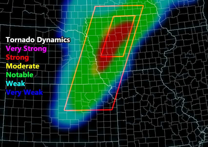
The graphic above shows the magenta watch area within the large red-shaded tornado watch. This magenta area is where the most violent tornado dynamics will be and the good chance of a strong/violent tornado of EF3 or stronger …
The rest of the tornado watch as you can see from the NWF Tornado Risk Analysis Model indicates notable, but weaker dynamics through Kansas and Southern MN … This would be along the main front for embedded tornado dynamics inside it, not ahead of it like the Iowa storms will produce …
In addition to the tornadoes, very large hail and damaging winds will accompany the entire watch area …
HOW TO GET THESE ALERTS?.
SIGN-UP TO THE FREE NWF E-MAIL ALERT SYSTEM FOR YOUR AREA HERE WHERE YOU PICK YOUR AREA IN YOUR OWN CONTROL PANEL BY STATE LOCATION AND GET NOTIFIED WHEN A POST IS MADE FOR YOU https://www.nationalweatherforce.com/national-weather-force-email-alert-system-sign-up/
FOLLOW the Facebook Page after reading this and interact with the post made about this, whether sharing, liking, or commenting … It will be answered
CLICK HERE TO FOLLOW THE MAIN FACEBOOK PAGE