
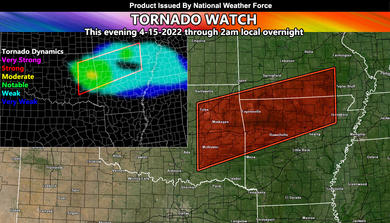
Issued or Partial Issued States: OK, AR, MO – Map inside shows affected state areas.
Site: National Weather Force has issued a Tornado Watch effective this evening through 2am overnight …
Date: 4/15/22 at 8:45am Central Time
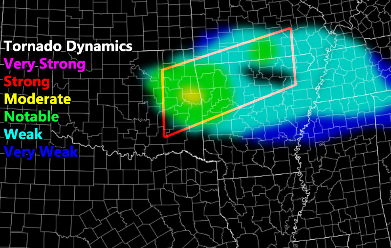
Forecast: A frontal zone will move into the area this afternoon across Southern Missouri, popping the storms off there first. As the evening moves in, southerly surface winds will increase and increase the dewpoint temperatures. This will work with 1000+ j k/g instability from Tulsa eastward through the Northwest half of Arkansas. This, plus SRH values of 150-200 m/s is sufficient for tornadoes to form in the watch zone.
The highest chance of a tornado will be the Fort Smith, AR forecast areas. This zone is the Weather Target for this watch. Storms will go below tornadic limits after midnight so I’ll end this watch at 2am.
Directional shear values at jet stream level suggests that some of these storms will be discrete, which means alone, and ups the tornado potential further.
In addition to the watch, large hail and damaging winds will be likely …
HOW TO GET THESE ALERTS?.
SIGN-UP TO THE FREE NWF E-MAIL ALERT SYSTEM FOR YOUR AREA HERE WHERE YOU PICK YOUR AREA IN YOUR OWN CONTROL PANEL BY STATE LOCATION AND GET NOTIFIED WHEN A POST IS MADE FOR YOU https://www.nationalweatherforce.com/national-weather-force-email-alert-system-sign-up/
FOLLOW the Facebook Page after reading this and interact with the post made about this, whether sharing, liking, or commenting … It will be answered
CLICK HERE TO FOLLOW THE MAIN FACEBOOK PAGE