
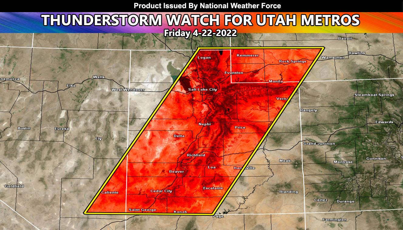
Issued or Partial Issued States: Utah – Map inside shows affected state areas.
Site: National Weather Force has issued a Thunderstorm Watch effective 10am Friday morning through 10pm Friday night for Utah, mostly along I-15 from Salt Lake City metro through to the NV/AZ border, where the most population resides – and all mountain terrain areas
Date: 4/21/22 at 12:15pm Pacific Time
Forecast: An upper level low will move into the area on Friday, bringing rain and snow to the state. The main focus will be the upper dynamics associated with it, including enough instability for thunderstorms to for along the watch area on Friday. These thunderstorms could have some hail with them, and gusty winds … The dynamics will fade around 10pm local Friday night and the watch will end …
A NWF Thunderstorm Watch is issued when dynamics in the area warrant thunderstorms that cover over 50% of the boxed area …
HOW TO GET THESE ALERTS?.
SIGN-UP TO THE FREE NWF E-MAIL ALERT SYSTEM FOR YOUR AREA HERE WHERE YOU PICK YOUR AREA IN YOUR OWN CONTROL PANEL BY STATE LOCATION AND GET NOTIFIED WHEN A POST IS MADE FOR YOU https://www.nationalweatherforce.com/national-weather-force-email-alert-system-sign-up/
FOLLOW the Facebook Page after reading this and interact with the post made about this, whether sharing, liking, or commenting … It will be answered
CLICK HERE TO FOLLOW THE MAIN FACEBOOK PAGE