
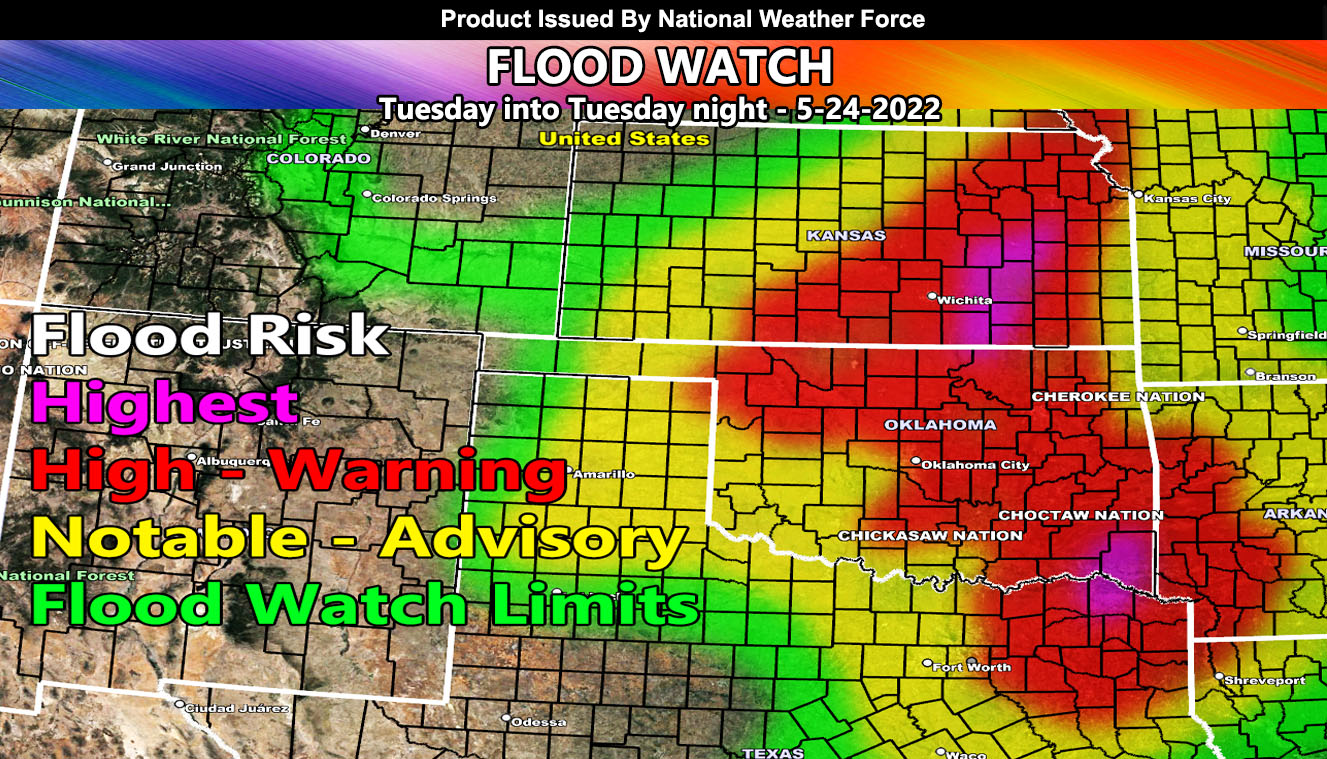
Issued or Partial Issued States: KS, OK, AR, TX – Map inside shows affected state areas.
Site: National Weather Force has issued a Flood Watch effective Tuesday into Tuesday night, May 24, 2022 …
Date: 5/22/22 at 6:45am Central Time
Forecast: An upper-level low will eject out of the Rockies on Monday night, starting the lift over the watch area where storms will be present in the Western TX/OK/KS areas, and spread eastward in the morning for the main watch zone.
Ongoing showers and thunderstorms will continue all day on Tuesday and into Tuesday night, which will add up to a lot of rainfall for the region, enough so that the model is painting a large area of red shade, which is considered a flood warning level event.
There is a chance of severe thunderstorms from Oklahoma into Texas, and any tornado dynamics will be addressed in future forecasts. So, if you are not on the free email alert system, get on it, the link is below –
A NWF Flood Watch means conditions are possible for heavy rainfall in a short period of time that can lead to flooding in spots. Hydroplaning on roadways is very likely in this type of scenario as well.
HOW TO GET THESE ALERTS?.
SIGN-UP TO THE FREE NWF E-MAIL ALERT SYSTEM FOR YOUR AREA HERE WHERE YOU PICK YOUR AREA IN YOUR OWN CONTROL PANEL BY STATE LOCATION AND GET NOTIFIED WHEN A POST IS MADE FOR YOU https://www.nationalweatherforce.com/national-weather-force-email-alert-system-sign-up/
FOLLOW the Facebook Page after reading this and interact with the post made about this, whether sharing, liking, or commenting … It will be answered
CLICK HERE TO FOLLOW THE MAIN FACEBOOK PAGE