
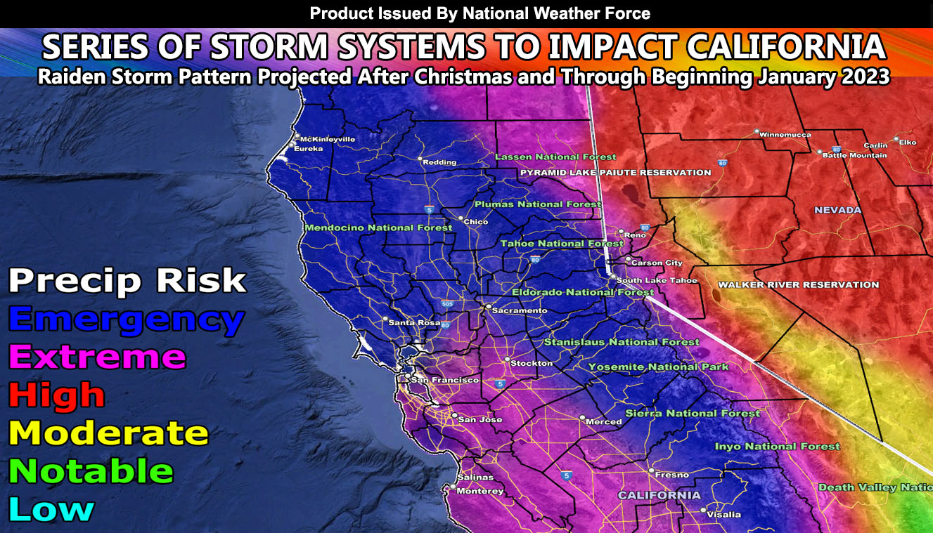
A major storm system will impact the state of California by Monday night into Tuesday (December 26-27), kicking off the first in a series of three or four systems moving in. The next system will start on Thursday and last into half of the weekend. The last one in the series as far as I can see will hit on Monday, January 2nd and go into the next day as well.
Given multiple storm fronts, areas like San Francisco through the Sacramento forecast zones will have 6-10″ of rainfall, and yes this is an emergency flood scenario. Not much else to talk about, but you should prepare for these systems as it will be the strongest one of the winter season thus far. The Sierra Nevada will easily see another 3-4 feet of snow with this.
SIGN-UP TO THE FREE NWF E-MAIL ALERT SYSTEM FOR YOUR AREA HERE WHERE YOU PICK YOUR AREA IN YOUR OWN CONTROL PANEL BY STATE LOCATION AND GET NOTIFIED WHEN A POST IS MADE FOR YOU https://www.nationalweatherforce.com/national-weather-force-email-alert-system-sign-up/
FOLLOW the Facebook Page after reading this and interact with the post made about this, whether sharing, liking, or commenting … It will be answered
CLICK HERE TO FOLLOW THE MAIN FACEBOOK PAGE
FIND NATIONAL WEATHER FORCE ON THE NEWSBREAK APP – CLICK HERE TO FOLLOW