
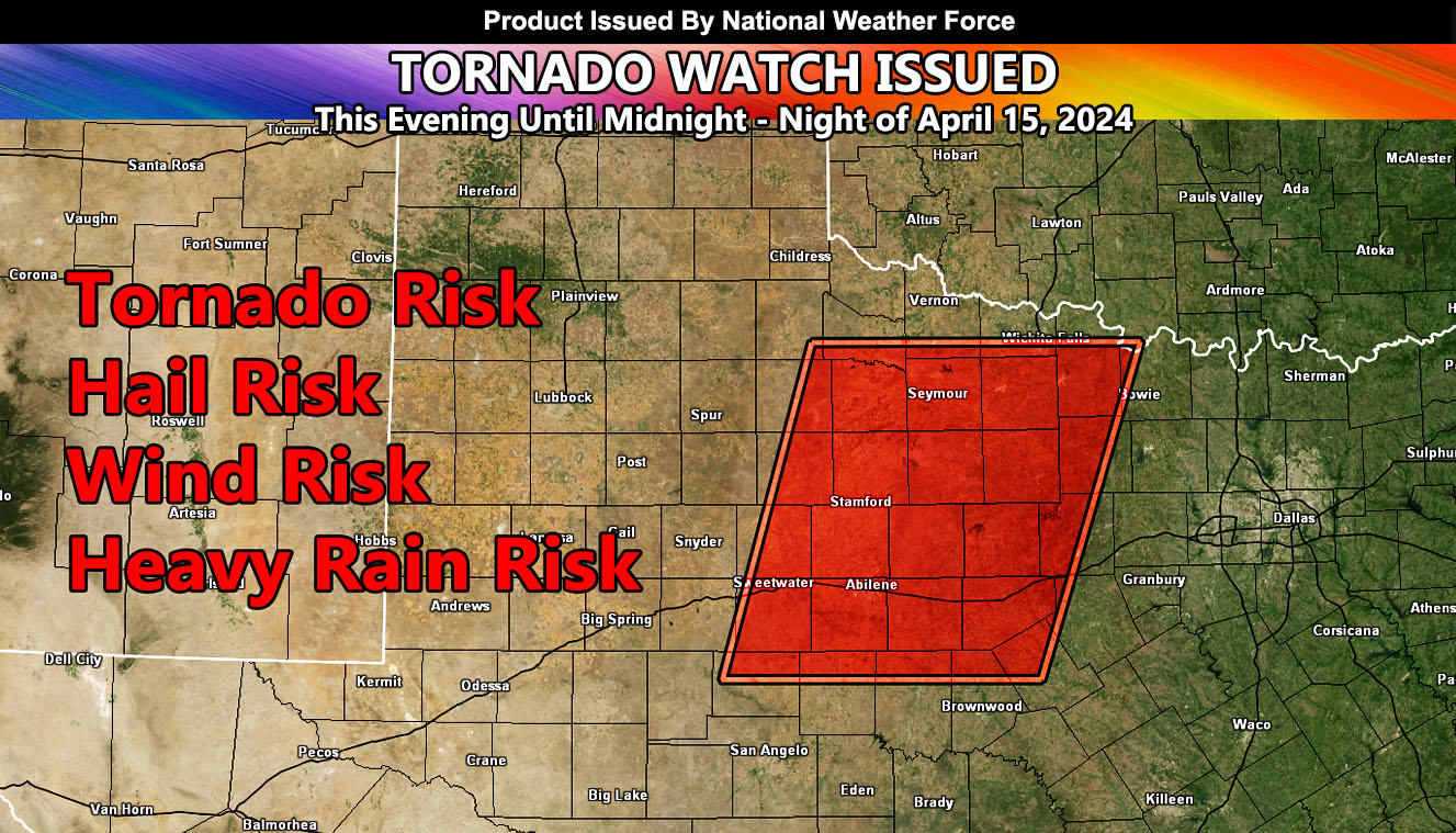
National Weather Force has issued a Tornado Watch effective this evening at 4pm CDT, until midnight CDT.
Zones: West-Central to Northwest Texas, especially north of I-20
Discussion: A dryline evident across West-Central Texas will be the focus spot for rapid thunderstorm development as an upper-level system ejects out of the Rocky Mountain Zones this evening. Storms will start to form between the 4-5pm CDT hour, and move east-northeast with time through the watch area.
This is a small watch area, but it will be the focus spot for the supercells early on to produce the best chance of tornadoes.
The focus spot for the highest tornado threat within the watch area will be Munday, Seymour, Throckmorton, and Haskell.
In addition to the tornado threat, large hail and damaging winds will also be likely.
A Tornado Watch issued here at National Weather Force means that severe thunderstorms are 100%, and a chance of tornadoes is there as well.
– Raiden Storm –
https://www.nationalweatherforce.com
Master General Meteorologist – is the owner and CEO of National Weather Force and is the only one authorized to issue weather watches here such as thunderstorm, tornado, hurricane, and severe. A consulting meteorologist with over 26 years’ experience for over 50 companies, including energy, agriculture, aviation, marine, leisure, and many more areas. He has certs from Mississippi State for broadcast met and Penn State forecasting certs MET 101, 241, 341 and 361 as a meteorologist, but before then was completely self-taught, barely learning a thing from the schools that he did not already know.